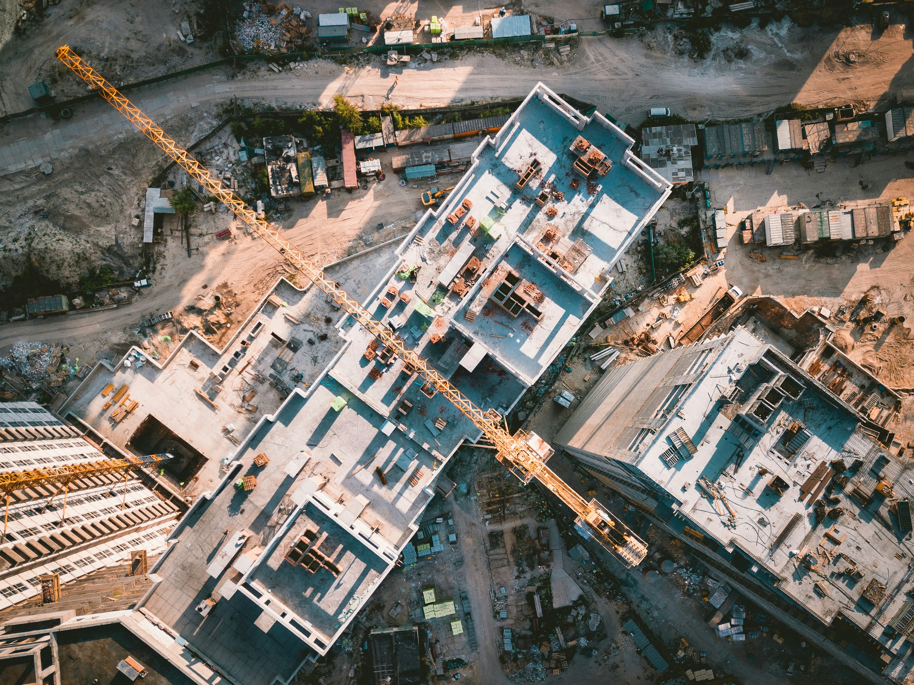
Site Progress Documentation
- Gives you a dated aerial record of every stage of the build, searchable, shareable, and always on file.
- Lets project managers verify what was actually completed and when, without relying on contractor reports alone.
- Keeps clients and stakeholders in the loop with visuals that are clear without needing to be on site.
- Doubles as portfolio and marketing content for future proposals and bids.
E.g., Aerial records confirm how much work was completed before a weather delay. The footage becomes the evidence that settles the contractor dispute.
Pre/Post Surveys
- Establishes a clear before-and-after record that makes change detection and volume measurement straightforward.
- Documents exactly what the site looked like on day one and confirms final grades match the approved plan.
- Provides the kind of documented evidence that supports bond releases, permit sign-offs, and compliance reviews.
- Delivers clean comparison visuals for closeout reports that clients and owners can actually use.
E.g., A post-construction survey confirms drainage grades match the approved plan, supporting the performance bond release on time.
Safety Compliance Monitoring
- Provides an overhead record of site conditions, access control, and PPE compliance without interrupting work on the ground.
- Documents hazardous areas, unsafe practices, and proximity violations in a format that holds up for health and safety reporting.
- Gives safety managers a site-wide picture that is impossible to get from a ground-level walkthrough alone.
- Builds a timestamped compliance record useful for audits, incident investigations, and insurance purposes.
E.g., Aerial footage catches workers in a restricted zone without PPE. The safety manager has a timestamped record before the incident review, not after.
Developer Marketing Content
- Delivers cinematic aerial visuals of active builds that give buyers and investors a compelling picture of the project before completion.
- Captures the scale, location, and surroundings of a development in a way no ground-level photo can communicate.
- Gives sales teams and marketing agencies polished content for presale campaigns, investor decks, and project websites.
- Raw files or fully edited content delivered to fit your campaign timeline and brand guidelines.
E.g., A mid-construction condo development has aerial footage ready for the presale launch, with no waiting until the building is done.